
CSI360 Forensic 360 Tours and Mapping for Investigations, Emergency Planning, and Courts
Capture the Scene. Map the Environment. Present with Confidence.
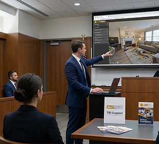
Triple R Investigations provides CSI360 forensic 360 tours and mapping services across Texas, delivering immersive, courtroom-ready documentation and spatial awareness for law enforcement, investigators, and emergency planners.
What Are CSI360 Forensic 360 Tours and Mapping Services?
CSI360 combines immersive 360 imaging with spatial mapping to create interactive digital environments of crime scenes, crash scenes, buildings, and critical locations.
These tours allow investigators, attorneys, and emergency responders to virtually navigate a scene, understand spatial relationships, and plan actions before, during, and after an incident.
Triple R Investigations provides CSI360 services throughout Texas and nationwide, supporting forensic documentation, emergency preparedness, and courtroom presentation.
Why 360 Mapping and Scene Documentation Matter
Traditional photographs and sketches capture pieces of a scene. CSI360 captures the entire environment and how it connects.
With CSI360, you can:
Revisit scenes after they are released
Understand spatial relationships in real context
Pre-plan emergency response routes
Identify access points, hazards, and visibility lines
Improve coordination between agencies
Present clear, defensible visual evidence in court
This is not just documentation. It is operational awareness and long-term scene preservation.
Who Uses CSI360?
Triple R Investigations is proud to serve various levels of public safety, fire, law firms, schools, businesses, emergency planners, forensic consultants, insurance investigators, and private investigators.

Law Enforcement Agencies

Crime scene investigators

Crash Reconstruction and Traffic Teams

Fire and Arson Investigators

Prosecutors and Defense Attorneys

Emergency management professionals

Schools and Public Safety Planners

Private Investigators and insurance Consultants
If your work involves explaining environments, CSI360 helps you show them instead.
How Triple R Investigations Delivers CSI360 Solutions
We deliver more than imaging. We deliver usable, operational environments.
1. Scene and Environment Capture
Using 360 cameras, DSLR systems, and LiDAR-supported workflows.
3. Interactive Tour Development
Building navigable environments with embedded markers and points of interest.
5. Secure Hosting and Sharing
Providing controlled access for agencies, investigators, and legal teams.
2. Spatial Mapping Integration
Capturing measurements, layouts, and structural relationships, including:
-
Entry and exit points
-
Hallways, rooms, and pathways
-
Exterior access routes
-
Key evidence locations
4. Planning and Analysis Support
Used for:
-
Investigative review
-
Emergency response planning
-
Training and scenario walkthroughs
6. Courtroom Presentation
Delivering professional, defensible visual tools for testimony.
Why 360 Mapping Outperforms Traditional Methods
Feature | Traditional Documentation | CSI360 Mapping and Tours |
|---|---|---|
Scene Perspective | Limited | Fully immersive |
Spatial Understanding | Fragmented | Integrated |
Ability to Revisit | No | Yes |
Emergency Planning | Minimal | High |
Courtroom Impact | Moderate | Strong |
CSI360 allows professionals to see the full environment, not just isolated evidence.
Why 360 Tours Matter in Forensics
Preserves spatial context
Supports remote scene review
Improves communication across teams
Strengthens courtroom understanding
Helps document more than isolated still images alone
Common CSI360 Use Cases


CSI360 Services in Texas and Nationwide
Triple R Investigations provides CSI360 forensic 360 tours and mapping services throughout Texas, including:
-
Canyon Lake
-
New Braunfels
-
San Antonio
-
Austin
-
Surrounding Hill Country region
We also support agencies and organizations nationwide through deployment, consulting, and training.
Whether you need a single scene documented or a full mapping and planning solution, TRI is ready to assist.

Experience That Translates to Real-World Results
Triple R Investigations is led by Dr. R. Ryan Rider, a retired law enforcement professional with over 30 years of experience in investigations, reconstruction, and public safety training.
Our approach combines:
-
Field-tested investigative experience
-
Advanced forensic and mapping technology
-
Courtroom-focused documentation practices
-
Emergency response and training insight
We understand how these tools are used in the field and how they must stand up in court.
Frequently Asked Questions
What is CSI360 used for?
CSI360 is used to document and map environments in an interactive 360 format for investigation, planning, and presentation.
Can CSI360 be used for emergency planning?
Yes. CSI360 allows responders to understand layouts, access points, and hazards before an incident occurs.
Is CSI360 useful in court?
Yes. CSI360 tours can be used as demonstrative evidence to help explain scenes clearly and accurately.
Do you provide CSI360 services in Texas?
Yes. Triple R Investigations provides services throughout Texas and can travel nationwide.
Can CSI360 be used beyond crime scenes?
Yes. It is highly effective for crash scenes, facilities, campuses, and any environment requiring detailed spatial understanding.
